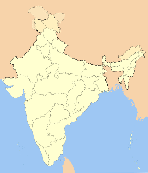
ꯐꯥꯏꯜ:India-locator-map-blank.svg

Size of this PNG preview of this SVG file: ৫১৪ × ৬০০ ꯄꯤꯛꯆꯦꯜꯁ. ꯑꯇꯩ ꯁꯦꯡꯅ ꯌꯦꯡꯕ ꯌꯥꯕ: ২০৬ × ২৪০ ꯄꯤꯛꯆꯦꯜꯁ | ৪১১ × ৪৮০ ꯄꯤꯛꯆꯦꯜꯁ | ৬৫৮ × ৭৬৮ ꯄꯤꯛꯆꯦꯜꯁ | ৮৭৭ × ১,০২৪ ꯄꯤꯛꯆꯦꯜꯁ | ১,৭৫৫ × ২,০৪৮ ꯄꯤꯛꯆꯦꯜꯁ | ১,৪৮৬ × ১,৭৩৪ ꯄꯤꯛꯆꯦꯜꯁ.
ꯐꯥꯏꯜ ꯑꯁꯦꯡꯕ (ꯑꯦꯁ•ꯚꯤ•ꯖꯤ ꯐꯥꯏꯜ, ꯌꯥꯝꯗꯅ ১,৪৮৬ × ১,৭৩৪ ꯄꯤꯛꯆꯦꯜ, ꯐꯥꯏꯜ ꯆꯥꯎꯕꯒꯤ ꯆꯥꯡ: ২৫২ KB)
ꯐꯥꯏꯜꯒꯤ ꯄꯨꯋꯥꯔꯤ
ꯆꯩꯆꯠ/ꯃꯇꯝꯗ ꯅꯝꯃꯨ ꯃꯇꯝ ꯑꯗꯨꯗ ꯐꯥꯏꯜ ꯑꯗꯨ ꯎꯅꯕ
| ꯆꯩꯆꯠ/ꯃꯇꯝ | ꯈꯨꯠꯄꯤꯈꯨꯖꯤꯟ | ꯄꯥꯛ ꯆꯥꯎꯕꯥ | ꯁꯤꯖꯤꯟꯅꯔꯤꯕ | ꯑꯄꯥꯝꯕ ꯐꯣꯡꯗꯣꯛ ꯎ | |
|---|---|---|---|---|---|
| ꯍꯧꯖꯤꯛꯀꯤ | ꯱꯹:꯳꯱, ꯱꯴ ꯑꯣꯛꯇꯣꯕꯔ ꯲꯰꯲꯰ |  | ১,৪৮৬ × ১,৭৩৪ (২৫২ KB) | NordNordWest | upd Telangana/Andhra Pradesh |
| ꯲꯳:꯱꯸, ꯲꯵ ꯖꯨꯂꯥꯏ ꯲꯰꯲꯰ |  | ১,৪৮৬ × ১,৭৩৪ (২৫২ KB) | NordNordWest | Jammu and Kashmir/Ladakh | |
| ꯰꯷:꯱꯲, ꯱ ꯑꯦꯄꯔꯤꯜ ꯲꯰꯱꯷ |  | ১,৪৮৬ × ১,৭৩৪ (৩৩৭ KB) | Utcursch | Moved Telangana to states layer | |
| ꯱꯹:꯳꯸, ꯲꯹ ꯖꯥꯅꯨꯋꯥꯔꯤ ꯲꯰꯱꯶ |  | ১,৪৮৬ × ১,৭৩৪ (৩৭৯ KB) | Csyogi | Telangana update | |
| ꯲꯱:꯰꯶, ꯱꯶ ꯃꯦ ꯲꯰꯰꯶ |  | ১,৪৮৬ × ১,৭৩৪ (৪২১ KB) | Nichalp | Siachen edits | |
| ꯱꯸:꯱꯹, ꯱꯳ ꯃꯦ ꯲꯰꯰꯶ |  | ১,৪৮৬ × ১,৭৩৪ (৪২৪ KB) | Nichalp | Siachen correction | |
| ꯱꯸:꯱꯳, ꯱꯳ ꯃꯦ ꯲꯰꯰꯶ |  | ১,৪৮৬ × ১,৭৩৪ (৪২২ KB) | Nichalp | border changes | |
| ꯱꯱:꯲꯳, ꯹ ꯃꯦ ꯲꯰꯰꯶ |  | ১,৪৮৬ × ১,৭৩৪ (৪২১ KB) | Nichalp | Updates as suggested in FPC | |
| ꯱꯳:꯱꯸, ꯷ ꯃꯦ ꯲꯰꯰꯶ |  | ১,৪৮৬ × ১,৭৩৪ (৪২১ KB) | Nichalp | Version 2; added some additional disputed areas in the Western sector | |
| ꯲꯳:꯵꯷, ꯶ ꯃꯦ ꯲꯰꯰꯶ |  | ১,৪৮৬ × ১,৭৩৪ (৪১৬ KB) | Nichalp | Blank locator map of India SVG Map drawn by me, ~~~~ category:Maps of India |
ꯐꯥꯏꯜꯒꯤ ꯁꯤꯖꯤꯟꯅꯐꯝ
ꯃꯇꯨꯡ ꯏꯟꯕ 2ꯂꯃꯥꯏ ꯁꯤꯖꯤꯟꯅꯕ ꯃꯁꯤꯒꯤ ꯐꯥꯏꯜ:
ꯃꯥꯂꯦꯝꯒꯤ ꯊꯥꯛꯇꯥ ꯁꯤꯖꯤꯟꯅꯕꯥ ꯐꯥꯏꯜ
ꯃꯁꯤꯒꯤ ꯐꯥꯏꯜ ꯑꯁꯤ ꯃꯈꯥꯒꯤ ꯑꯇꯩ ꯋꯤꯀꯤꯁꯤꯡꯅ ꯁꯤꯖꯤꯟꯅꯩ:
- as.wikipedia.org ꯗꯥ ꯁꯤꯖꯤꯟꯅꯩ
- as.wikiquote.org ꯗꯥ ꯁꯤꯖꯤꯟꯅꯩ
- awa.wikipedia.org ꯗꯥ ꯁꯤꯖꯤꯟꯅꯩ
- खाँचा:ज्ञानसन्दूक भारत कय क्षेत्र
- भारत कय राज्य
- भारत कय संघ राज्यक्षेत्र
- खाँचा:India States and Territories Labelled Map
- खाँचा:Infobox Indian Jurisdiction
- खाँचा:Infobox Indian Jurisdiction/Examples/city
- खाँचा:Infobox Indian Jurisdiction/Examples/district
- खाँचा:Infobox Indian Jurisdiction/Examples/neighbourhood
- खाँचा:Infobox Indian Jurisdiction/Examples/protected area
- खाँचा:Infobox Indian Jurisdiction/Examples/state
- खाँचा:Infobox Indian Jurisdiction/Examples/suburb
- खाँचा:Infobox Indian Jurisdiction/Examples/town
- खाँचा:Infobox Indian Jurisdiction/Examples/village
- खाँचा:Infobox Indian Jurisdiction/Sandbox
- खाँचा:Infobox Indian Jurisdiction/Sandbox/doc
- खाँचा:Infobox Indian Jurisdiction/doc
- खाँचा:ज्ञानसन्दूक भारत कय क्षेत्र/doc
- सीधी
- ban.wikipedia.org ꯗꯥ ꯁꯤꯖꯤꯟꯅꯩ
- bn.wikipedia.org ꯗꯥ ꯁꯤꯖꯤꯟꯅꯩ
- bpy.wikipedia.org ꯗꯥ ꯁꯤꯖꯤꯟꯅꯩ
ꯌꯦꯡꯉꯨ ꯃꯂꯦꯝꯒꯤ ꯊꯥꯛꯀꯤ ꯁꯤꯖꯤꯟꯅꯐꯝ ꯑꯗꯨ ꯃꯁꯤꯒꯤ ꯐꯥꯏꯜꯁꯤꯗ ꯫

